Pre-Hike Nutrition
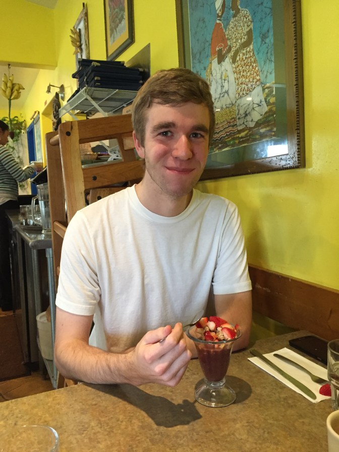
If you happen to be in the Santa Cruz area in the morning then I cannot recommend Cafe Brasil enough. It is a small, colorful house located on Mission Street. This was my third time dining there and every time it’s been packed (and for good reason!). Usually the wait time ranges from 20-40 minutes, but they’re very good about getting people seated and fed as quick as possible.
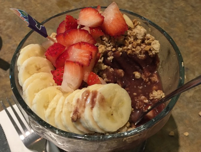
They’re well known for their Açaí Bowls so we made sure to get one before our hike.
The fresh cut fruit on top adds an energizing sweetness to the mix.
Check out their website here to see their menu, address, and hours.
The Hike
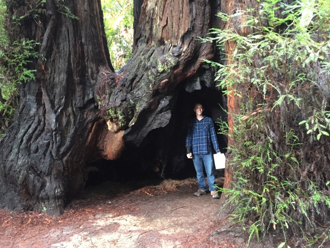
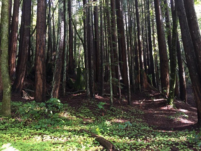
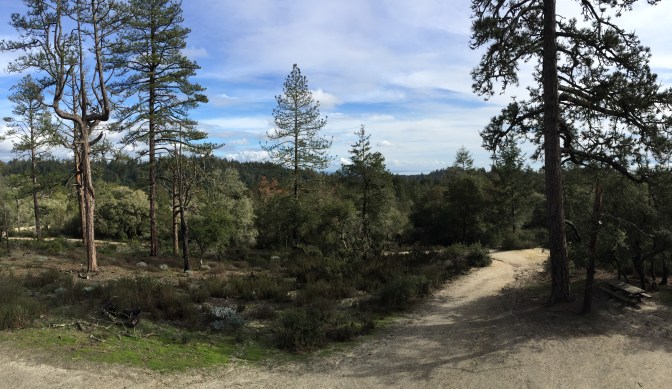
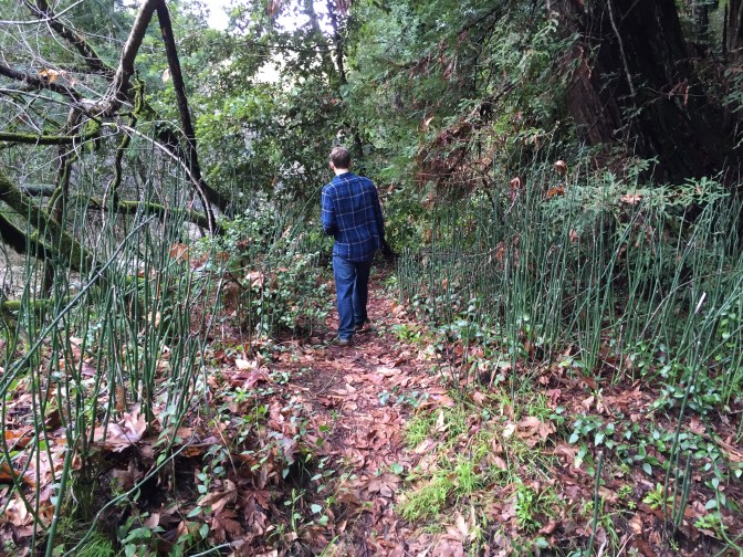
Our hike began in the super beginner section of Henry Cowell: the Redwood Grove. This is a short 3/4 mile hike that goes in a small loop. While this hike itself is short, it is far from unimpressive. The trail is littered with jaw-dropping redwood trees.
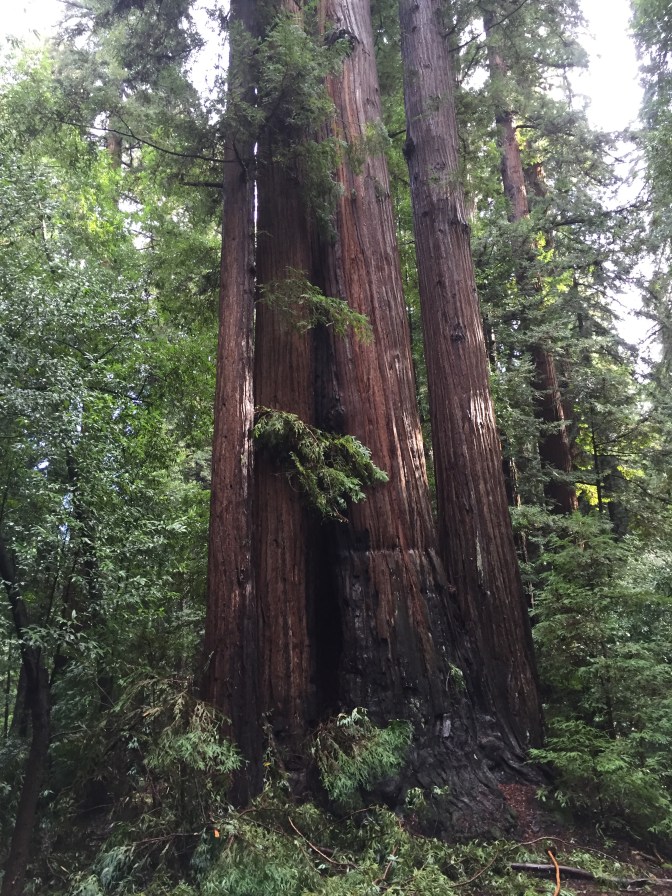
You can even go inside some of them!
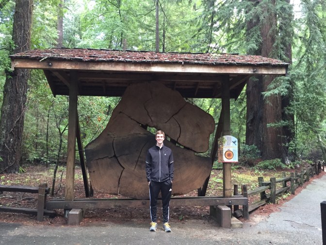
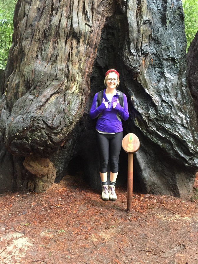
This trail also has a guide you can pick up with information about a lot of things you can see in the loop. In the picture below, I am standing by the number three, which has a paragraph about Redwoods and Fire. To read more or print your own guide for when you do the hike, click here.
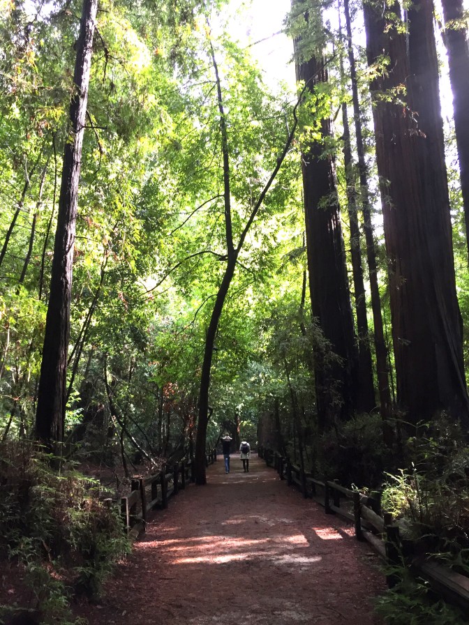
The size of the trail here is very wide and encourages a leisurely walk.
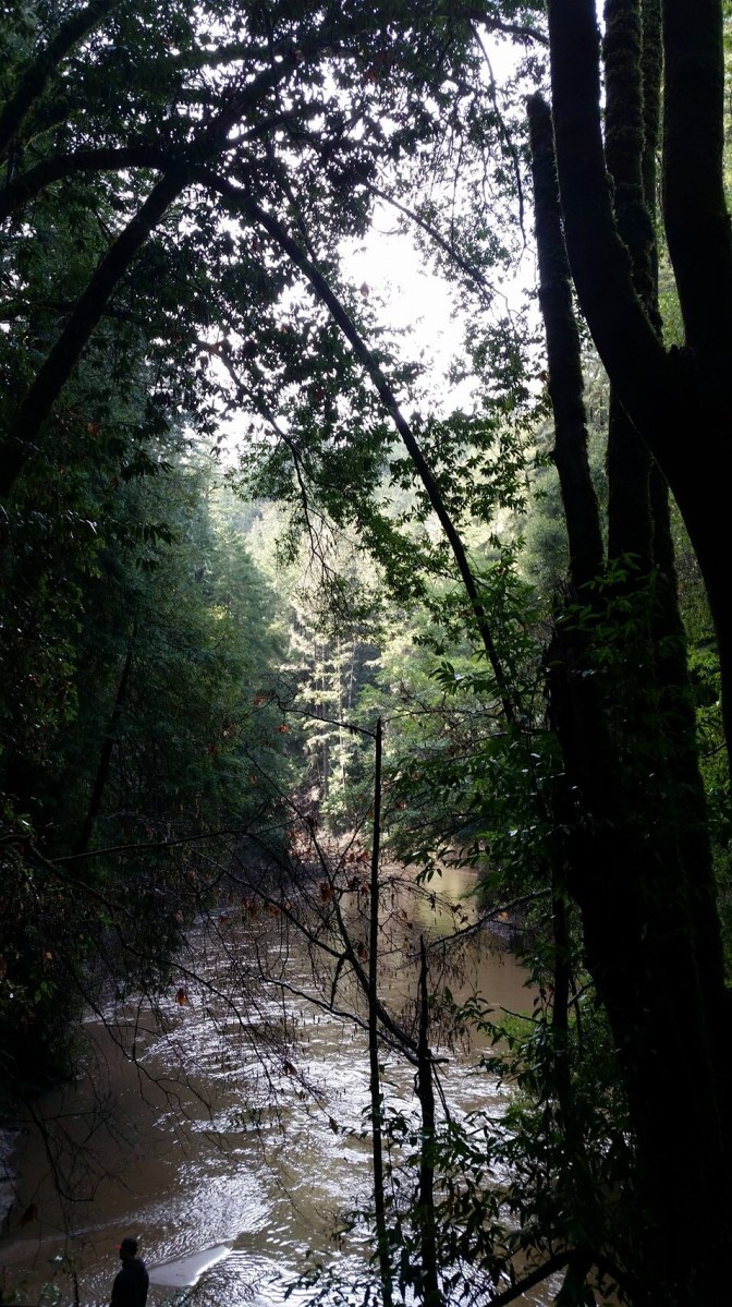
After about 0.4 miles of this trail, we reached the turning point of the loop. Instead of following through the loop and heading back to the car, we continued straight on towards the River Trail. This part of the trail runs parallel to the river and to Pipeline Road. The river was impressively high, especially after all of the glorious rain we’ve recently enjoyed.
After a short distance on the River Trail, we reached this sign:
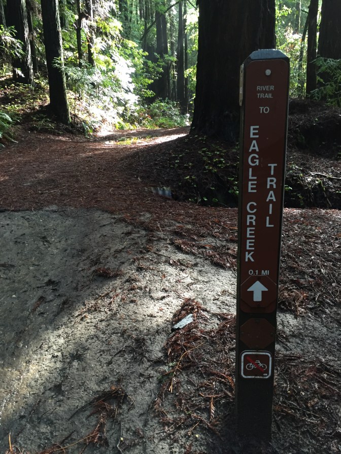
We unfortunately got a little bit confused as to where this sign was directing us to go and got a lost. The delay only added about 15 extra minutes to our hike, though, so it wasn’t a big deal. These signs are at many intersections, but not at all of them. It is advisable to bring a map and someone skilled at reading maps (not me).
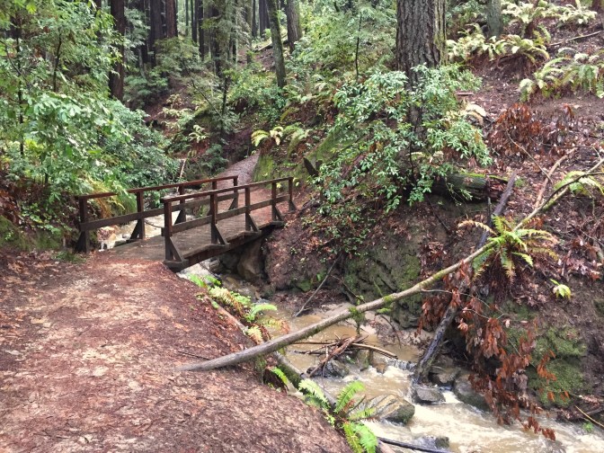
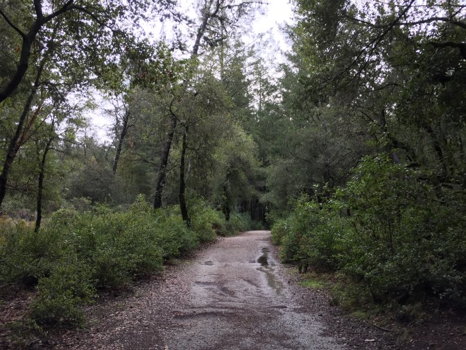
Once we were back on track, we started a slight upward climb through the woods while crossing over the creek a few times.
Clovers dot the ground everywhere in Henry Cowell State Park. We made sure to keep our eyes peeled for a four leaf one!
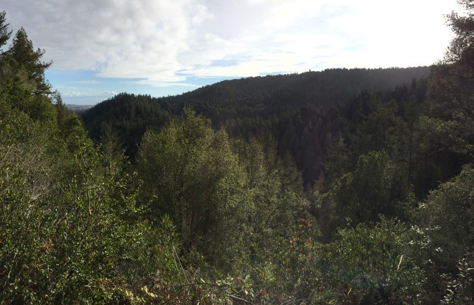
About 2.5 miles in to the hike, we completed the majority of our elevation gain (~750 feet according to EveryTrail) and reached the Observation Deck. The day was crystal clear after all of the rain on the previous day so we got to enjoy views for as far as the eye could see.
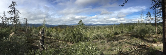
If you look far in the distance you can see Monterey Bay!
On the deck there was a sign with a quote from everyone’s favorite explorer, John Muir.
“Everybody needs beauty as well as bread, places to play in and pray in, where nature may heal and give strength to body and soul.”
I couldn’t agree with him more. Going outside and getting immersed in nature is the best way to reconnect with yourself and the world around you. Since the new year I’ve been making an effort to explore my home and the area around it on the weekends and I feel like I have actually noticed my mood improve.
Anyways, back to the hike!
At this point it was about 1:30pm and we decided we didn’t want to follow the original trail (see Stats section below for more details) and be done so soon. Instead, we agreed to extend our hike another 2-3 miles so we could follow the Buckeye Trail that leads down to the river.
This bit of the trail was more open to the sky than before since there were less trees.
It wasn’t until we began to descend towards the river that the giant redwoods began to pop up again.
This is the part that starts to get interesting. As we were crawling down the steep parts of the trail towards the San Lorenzo River, we passed a solo hiker. We smiled and said “hello” and he smiled back and said “There’s a river down there!”. We all nodded in agreement and thought “duh…that’s why we’re going”.
What Mr. There’s-A-River failed to mention to us was that the river was so overrun and the current was so fast that it was impossible to cross, therefore hindering any further hiking in that direction.
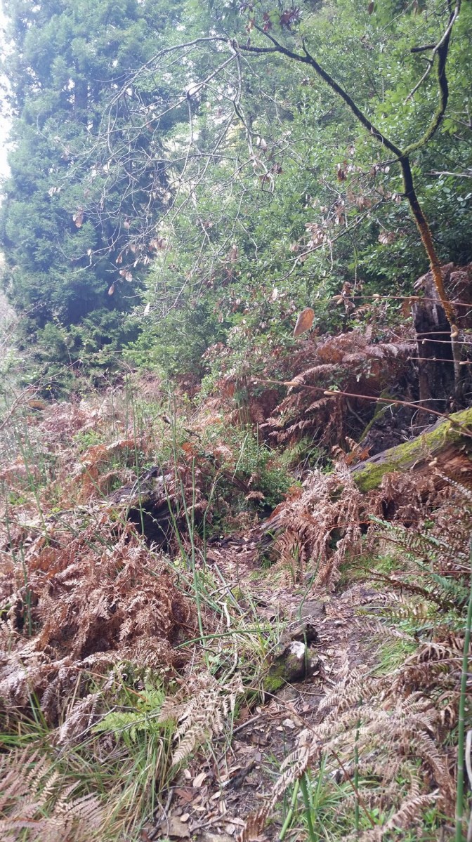
When we reached the river, we could immediately tell that something was off. The trail completely turned to nearly impassable mud and slush at one point.
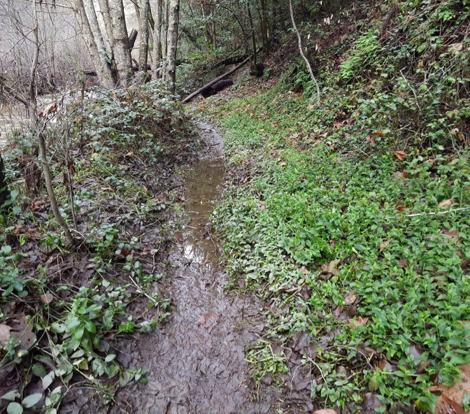
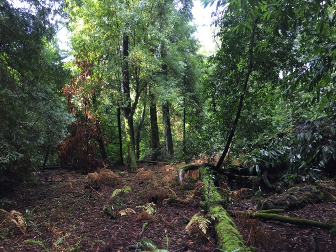
We braved on but our progress continually got slower as the trail thinned and more obstacles appeared. It almost looked as though a storm had blown forest debris on to the trail.
While this part was difficult, it was by far the most fun part of the day. This is the area where we had the most adventure.
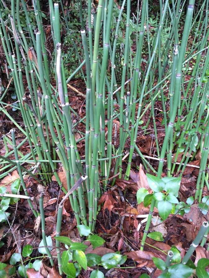
We found a plant that resembled bamboo and was full of water.
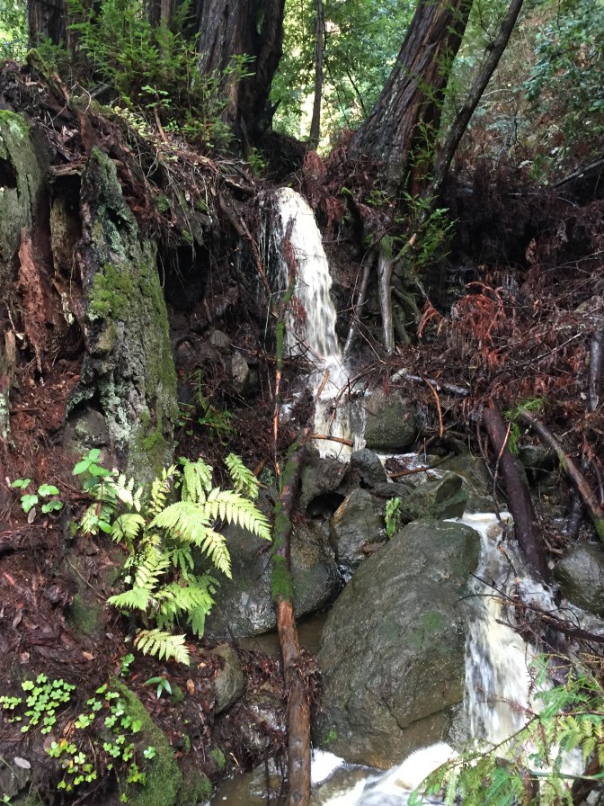
After squeezing ourselves underneath a fallen tree, we stumbled upon a small waterfall with a split in the trail we got to jump over.
For better views of this area check out my short video:
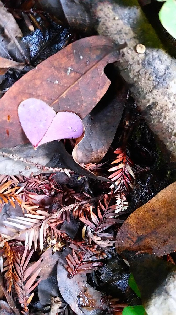
Some of the colorful leaves were still on the ground from autumn and we found a stunning purple leaf shaped like a heart.
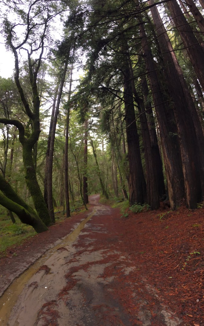
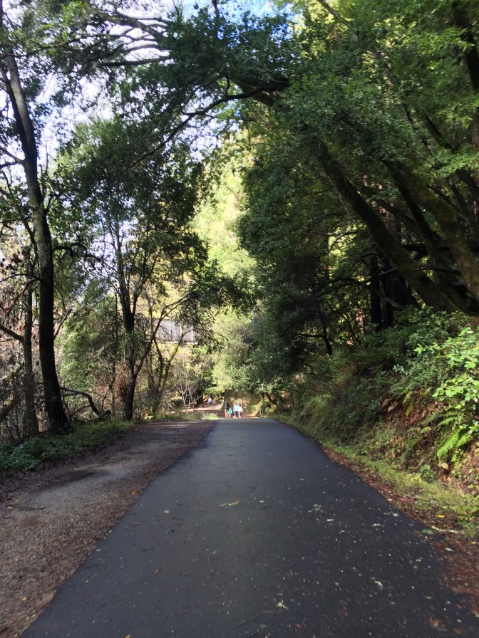
Eventually we had to turn back as it was getting dark, we couldn’t cross the river, and we lost the trail on the side we were on. We headed back up the trail we took down to the river and then turned on to the Pipeline Road to head the rest of the way back to the start.
This road is wide and paved, so there are lots of other hikers in these parts since there is no mud and dogs are allowed.
On the way back, there is an overlook with a few benches that makes for a great photo opportunity.
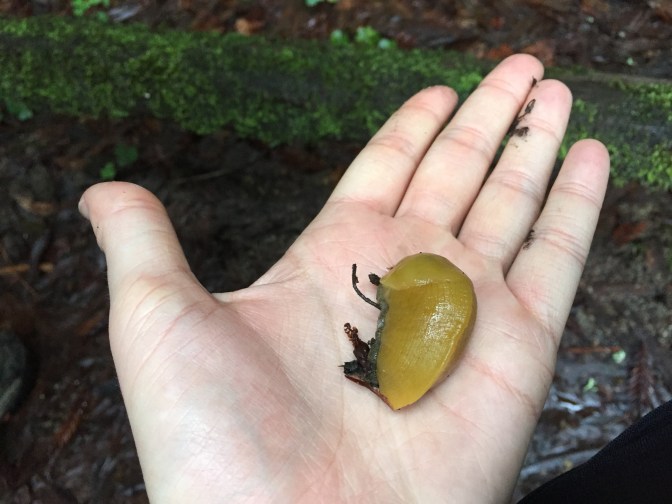
We finished up the hike with the remaining 0.4 miles of the Redwood Grove trail. We were feeling a little disappointed since we hadn’t seen any banana slugs our entire time, but right as we were discussing it, we found three!
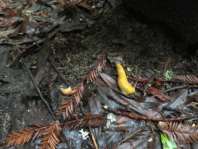
I even picked one up! I do not advise this unless you want your hand to be sticky and slimy for a long time.
Back in elementary school at Outdoor Ed I joined the Banana Slug Club by putting a banana slug on my nose. Does anyone else have a similar experience?
The Stats
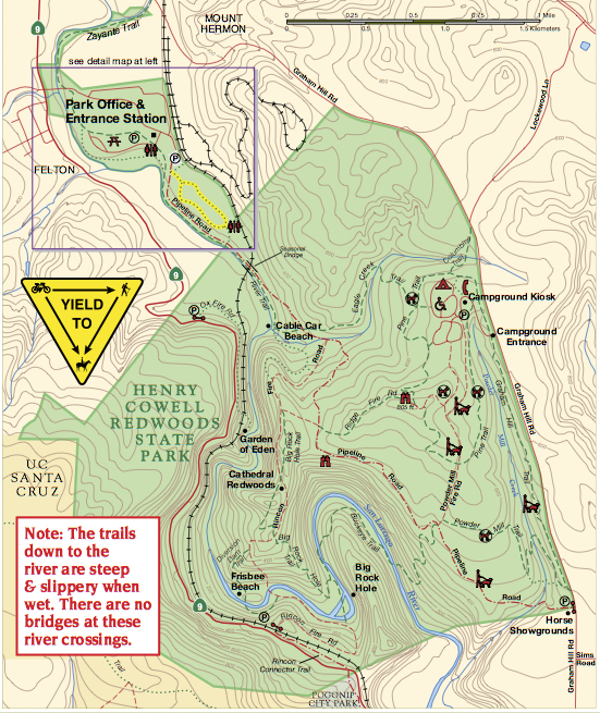
Henry Cowell State Park is a wonderful park that all levels of hikers can enjoy. Not only is it very clean and well-maintained, but there are a variety of trails available. There is a $10 entrance fee per vehicle and the gates close at 5pm. When driving to the park, be sure that you are turning to N Big Trees Park Road and not accidentally entering Roaring Camp, like we did. If you just type “Henry Cowell State Park” into your GPS, it most likely will bring you to the other place. See the map below for clarification:
I mentioned earlier that when we first began to hike, we were following a shorter trail. It has a grand total of 4.8 miles and is called the Observation Deck Loop. You can find more details of that hike here on EveryTrail.
The difference in our hike was that instead of taking the Ridge Fire Road back to the start of the hike, we instead continued down Pine Trail > Powder Mill Fire Road > Fire Mill Trail > Buckeye Trail. Our plan was to then cross the San Lorenzo River to continue on to Big Rock Hole Trail until we finished our hike back where started.
Conclusion
If you want an easy hike that is mostly shaded but still provides excellent views, the Observation Deck Loop is for you! It is not the most challenging hike to do, but it is very scenic.
If you want to add more challenge, like we attempted to do, then try to go when the river level will be low, like in the late spring or during the summer. Then you will be able to do the Buckeye Trail and complete the larger loop (~8 miles). I’m hoping to go back this summer and finish what we started!

Reblogged this on The Mobile Moser's and commented:
Here’s a post about a great place to RV from the perspective of my daughter and her blog about the Bay Area. Makes me want to camp there again soon!
LikeLike
I love your pictures and the waterfall…I could smell the earth through them…I have been to Henry Colwell Park, its beautiful there, we weren’t able to do much hiking with a bad knee, but we got out and enjoyed the redwoods….great drive up and around the mountains….banana slugs….I thought they were big ones down here, but I went to Alaska…wow they were huge….looks like you had a great time….
LikeLike